

Imagine a world where accurate weather forecasts, crucial for everything from your morning commute to national defense, suddenly become a luxury. This isn’t a dystopian novel; it’s the potential reality unfolding as the Defense Department reportedly phases out its provision of crucial satellite weather data. This decision, often framed as a strategic shift or cost-saving measure, sends ripples of concern through military strategists, civilian weather agencies, and anyone who relies on precise meteorological information.
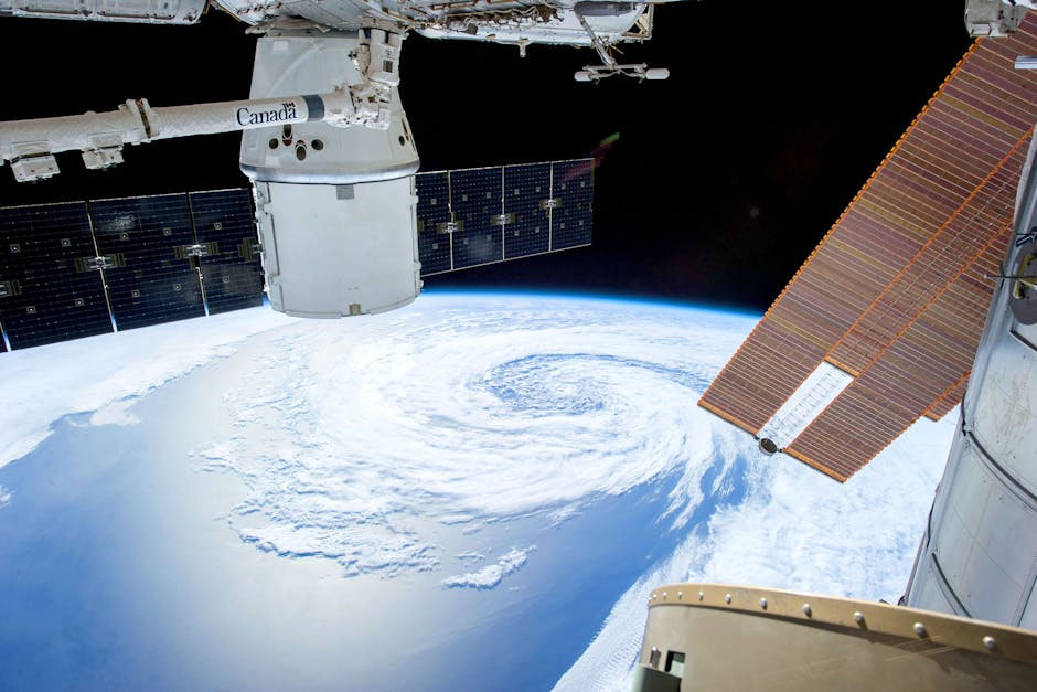
For decades, the Pentagon’s network of sophisticated weather satellites has been an unsung hero, quietly providing indispensable data. This isn’t just about whether it will rain on your parade; it’s about detailed atmospheric profiles, sea surface temperatures, ice floe movements, and global cloud cover – information vital for military operations, missile guidance, search and rescue missions, and intelligence gathering. Civilian agencies like NOAA and the National Weather Service also heavily leverage this data to issue severe weather warnings, track hurricanes, and inform agricultural planning, aviation, and shipping.
The exact reasons behind this significant withdrawal are multifaceted, often cited as budget reallocations or a move towards greater reliance on commercial satellite providers. While outsourcing data collection might seem efficient on paper, it raises critical questions about data quality, security, and guaranteed access during times of crisis. Can commercial entities truly replicate the comprehensive, global, and secure data stream that a dedicated military program provides, especially under adverse conditions or during a national emergency?
The immediate impact on military operations could be profound. Naval fleets depend on precise oceanographic and atmospheric data for deployment and navigation. Air Force missions require accurate wind speeds, turbulence forecasts, and visibility reports. Ground troops need real-time weather intelligence for everything from logistical planning to tactical maneuvers. Losing direct control over this data stream could create dangerous blind spots, potentially jeopardizing missions and personnel.
Beyond the battlefield, the civilian repercussions are equally alarming. Our national preparedness for natural disasters – hurricanes, tornadoes, blizzards, and floods – hinges on the most accurate, timely weather data available. Without the comprehensive input from DoD satellites, civilian weather models might suffer from reduced accuracy and resolution, leading to less reliable forecasts, slower warning times, and potentially increased risks to public safety and infrastructure. Industries like agriculture, transportation, and energy, which are highly sensitive to weather patterns, could also face significant economic disruptions.
The crucial question remains: what is the comprehensive plan to fill this critical data void? While there’s a push for collaboration with commercial providers and international partners, the transition is fraught with challenges. Ensuring seamless data integration, maintaining high standards of data fidelity, and guaranteeing access in a fragmented landscape are complex tasks with potentially severe consequences if not executed flawlessly. This isn’t merely about turning off a data tap; it’s about dismantling a cornerstone of our national security and public safety infrastructure.
As the Defense Department proceeds with this controversial decision, it’s imperative that the public, policymakers, and industry stakeholders demand transparent answers and a robust strategy to mitigate the risks. The skies ahead, both literally and figuratively, depend on it. Failing to adequately address this critical data gap could leave us all vulnerable, adrift in an increasingly unpredictable world.